
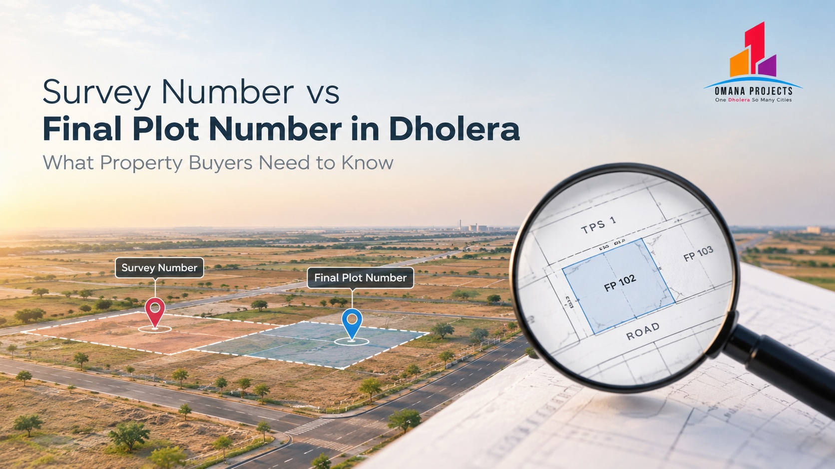
Understand survey numbers, final plot numbers and TP schemes in Dholera. Learn which records to check before buying a plot and how to spot inconsistencies
Survey Number vs Final Plot Number in Dholera: What Property Buyers Need to Know
When researching a plot in Dholera, buyers may encounter several identifiers in brochures, land records, layout plans, agreements, and town planning documents. Two terms that can cause confusion are survey number and Final Plot (FP) number.
A survey number is associated with the identification of land in relevant land or revenue records. A Final Plot number is associated with a plot identified through the applicable town planning framework, where such a scheme and final plot designation apply.
For a buyer, the important question is not simply whether a number appears in a brochure. It is whether the property's identifiers can be traced through the appropriate official records and matched to the exact parcel being sold.
This guide explains the difference, why Town Planning (TP) schemes matter, and what to verify before purchasing a property in Dholera SIR or the wider Dholera region.
What Is a Survey Number?
A survey number is a land identifier used in relevant land and revenue records. It helps distinguish a parcel or landholding within the applicable record system.
Depending on the property and its history, documents may also refer to subdivisions, sub-survey numbers, old and new identifiers, or other parcel details. These identifiers should be read in the context of the records in which they appear.
For a buyer, the survey number is a starting point for identifying the land described by the seller. It is not, by itself, a complete guarantee of ownership, permitted use, development approval, or the right to build.
Before relying on a survey number, check the relevant land records and supporting documents. Confirm that the recorded owner, area, boundaries, and other material details are consistent with the property being offered.
What Is a Final Plot Number?
In a Town Planning scheme, a Final Plot number In Dholera identifies a plot within the scheme's planning framework. The scheme may reorganise land and establish planned plots, roads, public facilities, and other land-use arrangements according to the applicable legal process.
In Dholera SIR, TP schemes are important because the development framework uses planned areas and plot designations. However, buyers should not assume that every property marketed as a Dholera plot has a Final Plot number under a notified SIR scheme.
A property may be in the wider Dholera region but outside the notified SIR boundary. The planning and land-record documents applicable to that property may therefore differ from those for a plot within SIR.
The Final Plot number must be verified against the relevant approved or notified scheme records and the documents for the specific parcel.
Survey Number vs Final Plot Number: The Main Differences
Survey Number
- Identifies a land parcel in the relevant survey or revenue records.
- Appears in relevant land, survey, and revenue documents.
- Helps establish which land parcel the records refer to.
- Does not, by itself, prove clear title, permitted land use, or development approval.
- Buyer’s next step: Match the survey number with ownership records and parcel details.
Final Plot (FP) Number
- Identifies a plot under the applicable town planning framework.
- Appears in relevant Town Planning (TP) scheme records and related plot documents.
- Helps identify the planned plot within the applicable scheme.
- Does not, by itself, prove clear ownership, unrestricted transfer rights, or that every required approval is in place.
- Buyer’s next step: Match the FP number with TP scheme documents, plot plans, and transaction records.
The two identifiers may be connected in the records relevant to a particular property, but buyers should not assume that the relationship is identical in every case. Ask the competent authority or a qualified local property lawyer to explain how the land is identified before and after the relevant planning process.
Why TP Schemes Matter in Dholera SIR
Dholera SIR is a planned industrial and urban development region. Its planning framework includes Town Planning schemes that organise land and infrastructure within defined areas.
The applicable scheme can help a buyer understand the planned location of a plot, its relationship to roads and public facilities, and the land-use framework that applies. But a TP label alone should not be treated as proof of the property's legal status.
When reviewing a property described as being in TP1, TP2, TP4, or another scheme, confirm:
- The exact scheme and relevant plot identifier.
- Whether the property actually falls within the scheme.
- The applicable land use and any conditions.
- The relevant plan or record showing the plot's location.
- Whether the seller's documents correspond with those records.
- Whether any later changes, corrections, or conditions affect the parcel.
A buyer should also establish whether the property is inside the notified Dholera SIR boundary. The word “Dholera” is often used broadly for the surrounding region, so the location must be verified rather than inferred from a marketing description.
How to Verify a Plot's Identifiers Before Buying
Step 1: Request the complete property description
Ask the seller or developer for the exact village, survey number and subdivision where relevant, plot or Final Plot number if applicable, plot area, and boundary description.
Do not accept a generic location or project name as a substitute for parcel identification.
Step 2: Obtain the relevant land records
Request the applicable ownership, revenue, and registration documents. The exact records depend on the property's legal and administrative circumstances.
Have a qualified property lawyer review the chain of title and determine whether the seller has the authority to transfer the property.
Step 3: Check the applicable TP scheme records
If the property is represented as being within Dholera SIR and a particular TP scheme, request the relevant scheme and plot records. Confirm that the stated plot number and location match the applicable documents.
If a Final Plot number is not applicable, ask what official identifiers and plans establish the parcel's identity instead.
Step 4: Match the identifiers across documents
Compare the survey details, plot or FP number, area, village, boundaries, and owner information across the available records and proposed agreement.
Differences do not automatically mean that a transaction is invalid; records may reflect changes or different stages of a planning process. But inconsistencies should be explained and documented before proceeding.
Step 5: Check land use and applicable permissions
Confirm the permitted use of the land and any applicable NA permission, layout approval, development approval, or other requirements.
Do not infer residential, commercial, SCO, or industrial permission solely from a sales brochure or the presence of a plot number.
Step 6: Inspect the site
Where possible, visit the property and compare its physical location with the relevant plan and boundaries. Check the access road and surrounding conditions.
A site visit is useful, but it does not replace legal verification. Likewise, a map pin does not establish ownership or the official SIR boundary.
Step 7: Review the sale agreement
The agreement should identify the property consistently with the supporting records. Have a qualified lawyer check the description, area, payment terms, seller's authority, conditions, and remedies if the transaction cannot proceed as represented.
Resolve unexplained identifier mismatches before signing or paying a substantial amount.
What If the Survey Number and Final Plot Number Do Not Match?
Different identifiers can appear in different records because they serve different purposes. The fact that a survey number and an FP number are not identical does not, on its own, establish a problem.
The important issue is whether the relationship between the identifiers can be demonstrated through the applicable official records.
If the documents refer to different areas, villages, boundaries, or owners, do not assume that the difference is merely administrative. Ask for the relevant scheme records, maps, supporting documents, and a written explanation from the responsible party.
If the discrepancy remains unresolved, seek independent legal advice and clarification from the competent authority before proceeding.
Never rely solely on an oral assurance that the records will be corrected after purchase.
Inside Dholera SIR vs Outside the Notified Boundary
The distinction between properties inside SIR and those in nearby villages is especially important.
For a property inside the notified SIR boundary, the applicable planning framework and TP scheme records may be central to the verification process.
For a property outside SIR, buyers should examine the records and approvals applicable to that land and its competent authority. Do not assume that an SIR Final Plot designation applies simply because the property is close to Dholera.
This distinction affects how the property should be described, which planning records should be checked, and which authority may be responsible for the relevant approvals.
The property's actual location should be established using reliable records, not solely a project name, map label, road distance, or promotional claim.
Common Mistakes Buyers Should Avoid
Mistake 1: Treating a plot number as proof of clear title. A number helps identify land, but ownership and transfer rights require separate verification.
Mistake 2: Assuming every Dholera plot has an FP number. The relevant identifiers depend on the property's location and applicable planning framework.
Mistake 3: Ignoring the survey details. The survey identifier and supporting records help establish which land is actually involved in the transaction.
Mistake 4: Relying only on a brochure. Request the underlying documents and check that they match the property being offered.
Mistake 5: Confusing proximity with SIR inclusion. A property near Dholera SIR is not necessarily inside its notified boundary.
Mistake 6: Assuming a planning designation guarantees permission to build. Confirm land use and all applicable permissions independently.
Mistake 7: Leaving inconsistencies until after payment. Resolve material discrepancies before making a commitment.
A Buyer’s Document Checklist
Before proceeding with a plot purchase, ask a qualified local property lawyer to review the documents relevant to your transaction. These may include:
- Ownership and chain-of-title documents.
- Relevant survey and revenue records.
- Survey number, subdivision, and parcel details where applicable.
- Final Plot number and TP scheme records where applicable.
- Relevant maps, layouts, and boundary descriptions.
- Land-use and NA permissions where required.
- Layout or development approvals where applicable.
- Encumbrance, litigation, and charge-related checks.
- RERA registration or an assessment of applicability where relevant.
- Access rights and the sale agreement.
- Current records establishing the competent authority and the property's location.
Not every document applies to every land transaction. The correct checklist depends on the property, the seller, the planning framework, and the intended use.
Frequently Asked Questions
Is a survey number the same as a Final Plot number?
No. A survey number identifies land in relevant survey or revenue records, while a Final Plot number identifies a plot under an applicable town planning framework. Their relationship should be checked in the official records for the specific property.
Does a Final Plot number prove ownership?
No. It is a planning-related identifier. Buyers must separately verify ownership, transfer authority, applicable permissions, and other legal matters.
Do all plots in Dholera have a Final Plot number?
No. The relevant identifier depends on the property's location and planning status. A plot outside the notified SIR boundary may be governed by a different set of records and approvals.
How do I verify a Dholera TP scheme?
Request the relevant official scheme and plot records and confirm that the property's location and identifier match. Seek clarification from the competent authority or a qualified property lawyer if the documents are unclear.
What should I do if property documents show inconsistent plot details?
Pause the transaction and request supporting records and a written explanation. Have a qualified lawyer assess the discrepancy before signing or paying a substantial amount.
Conclusion
Survey numbers and Final Plot numbers help identify land in different record and planning contexts, but neither should be treated as a complete substitute for legal due diligence.
For a Dholera property, establish the exact parcel, verify the relevant land and planning records, check the applicable land use and permissions, and confirm whether the property is inside or outside the notified SIR boundary.
The most reliable purchase decision is one where the property described in the agreement can be traced clearly through the relevant records and matched to the land being sold.